It’s just a fortnight until our 2 day MBO event based at Askrigg Camping on Saturday 14th and Sunday 15th September.
Enter Saturday here and Sunday here
IMPORTANT ENTRY NOTE: When you pay for your entry on WorldPay, make sure to click the link to return to the BMBO site as this ensures your registration is confirmed. If you get a WorldPay confirmation but can’t see yourself on the BMBO start list, please get in touch!
Saturday starts are between 1200-1300 and Sunday 1000-1100.
Camping: Please fill out the form below to reserve a camping pitch for one or both nights (£8 per adult). The site has water and toilets and is close to the brewery and village pubs. There will be a generator with sockets for riders to recharge their phones or ebike batteries.
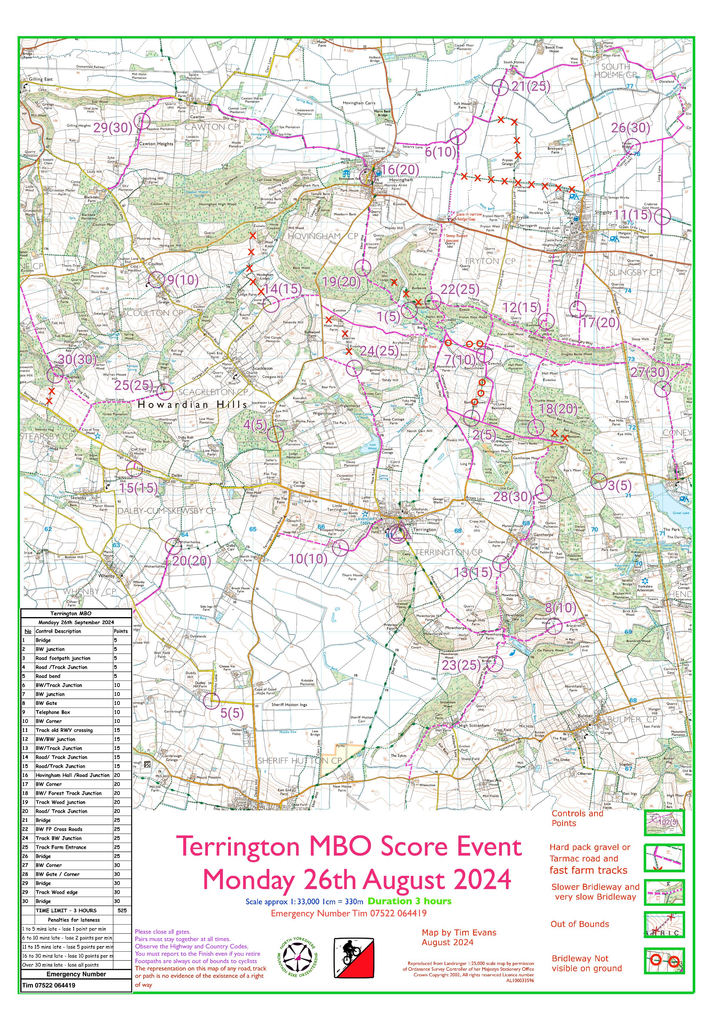
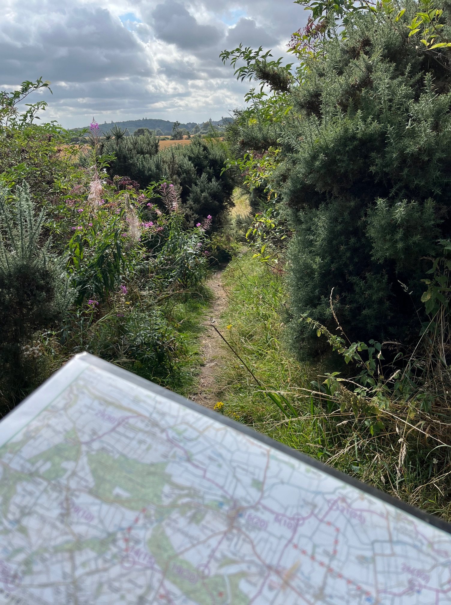
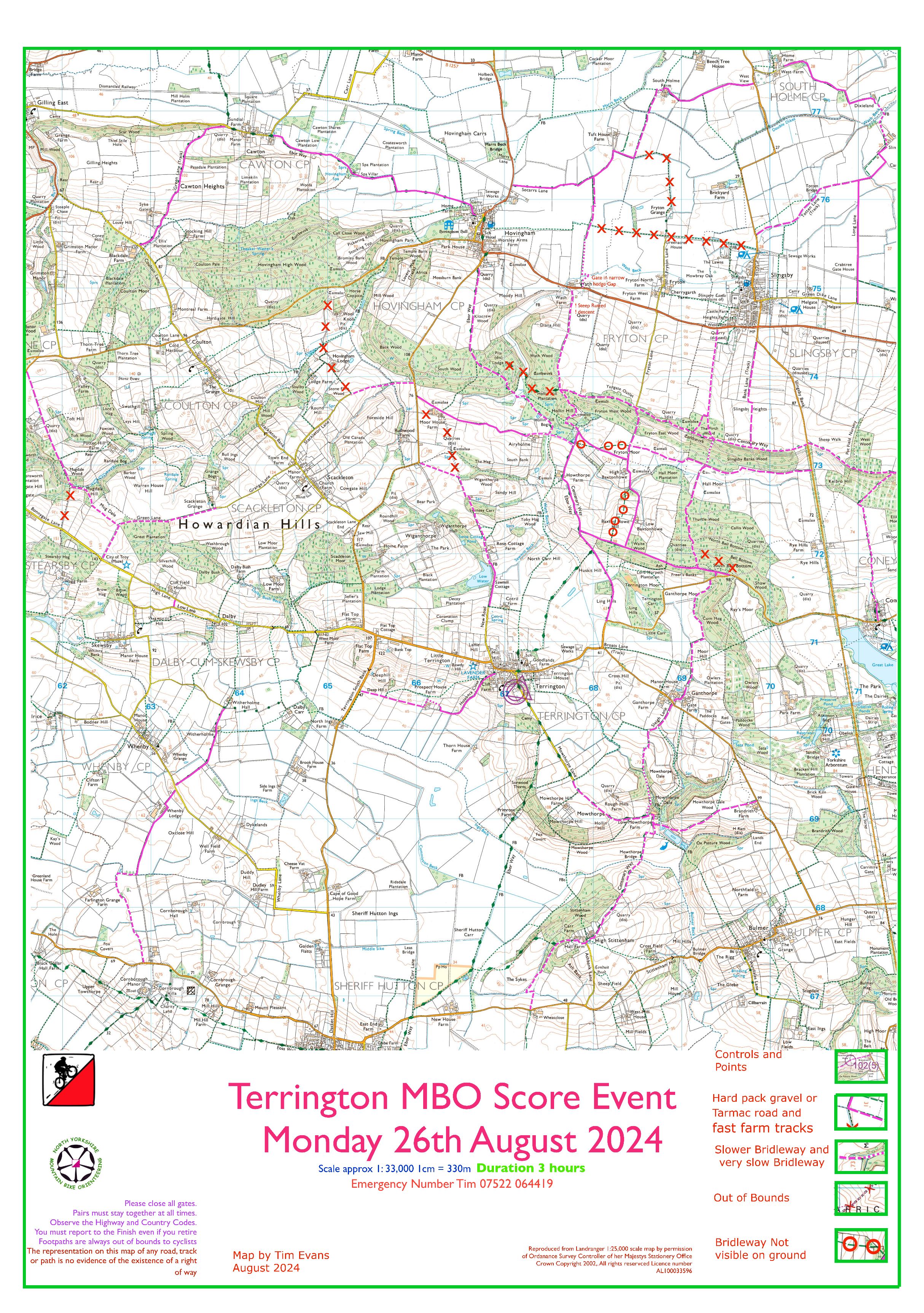
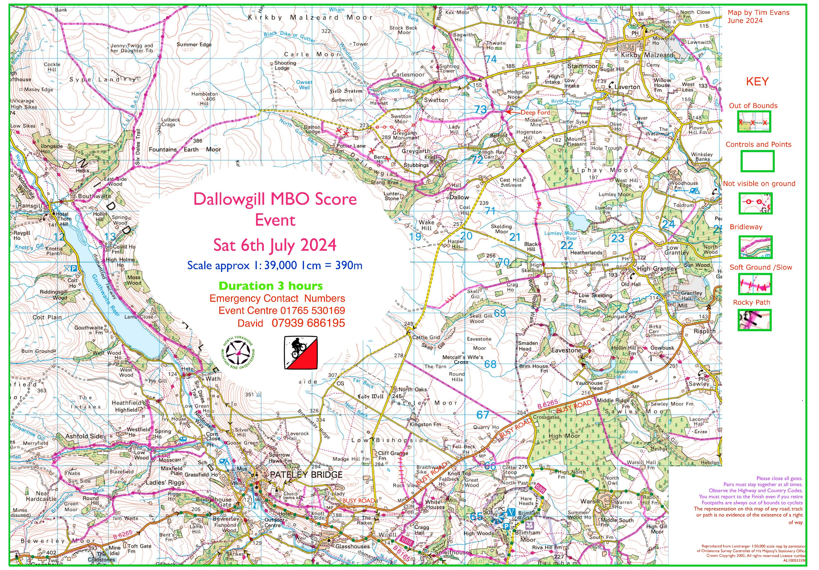
Steve has finished checking the bridleways and controls on Maprun for both days. It’s a beautiful area with stunning views and a variety of excellent and tough tracks. Plenty of hills which are even tougher into the prevailing westerly wind and plenty of gates which all need closing! Hopefully the tracks will stay as dry for the next fortnight especially the fords which will be assessed the day before.
We have got permission to ride a number of private tracks each day but please don’t ride them beforehand when the blank maps are posted online.
Free refreshments when you finish each day and prizes for the overall winners in each class (of 3 riders or more)
Don’t forget to enter by next weekend to get a 25% discount and download the Maprun files when they are announced. Hope to see you there!!
Also, the league results after 5 events can be found here: NYMBO League 5 events


 Carperby Moor