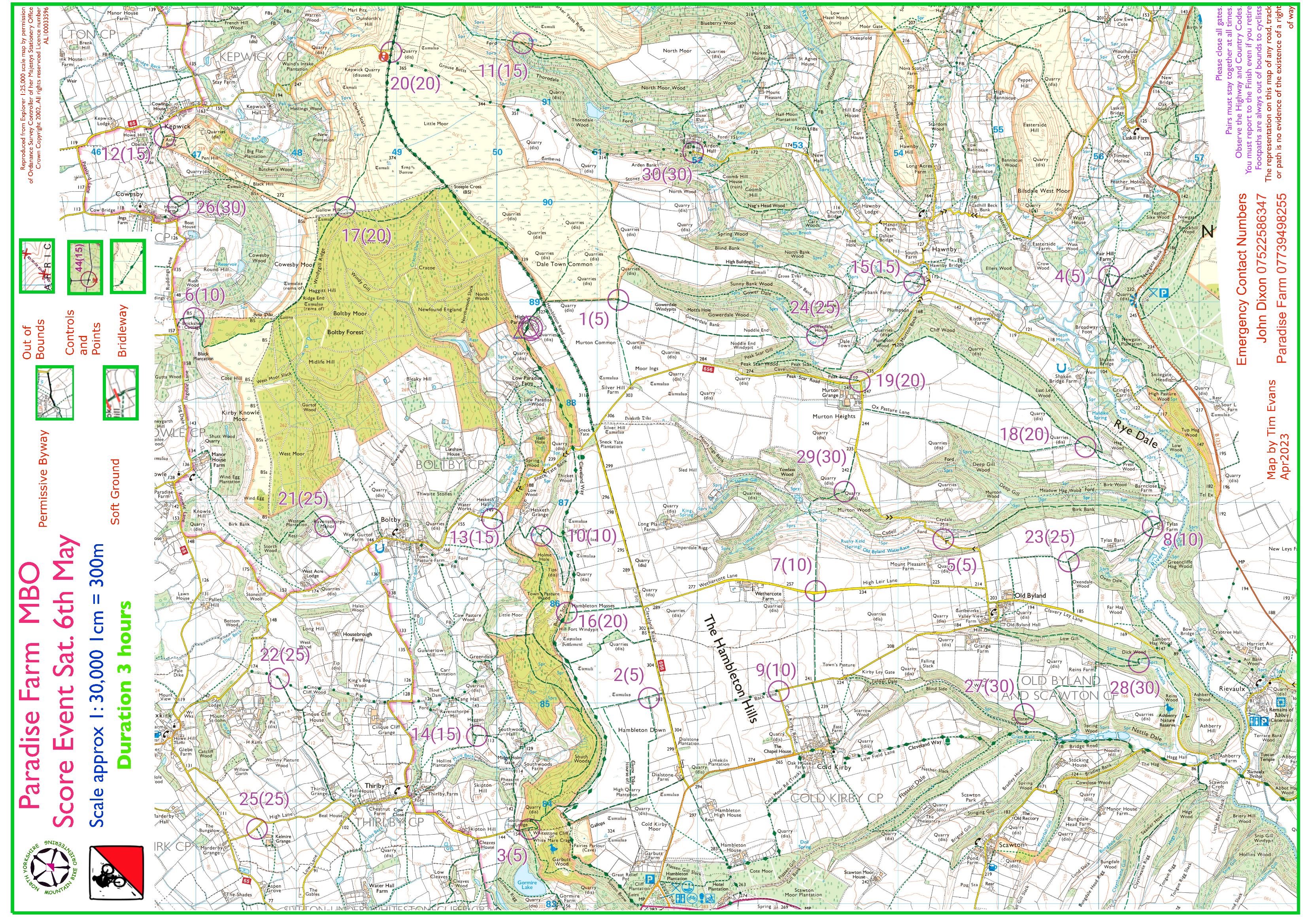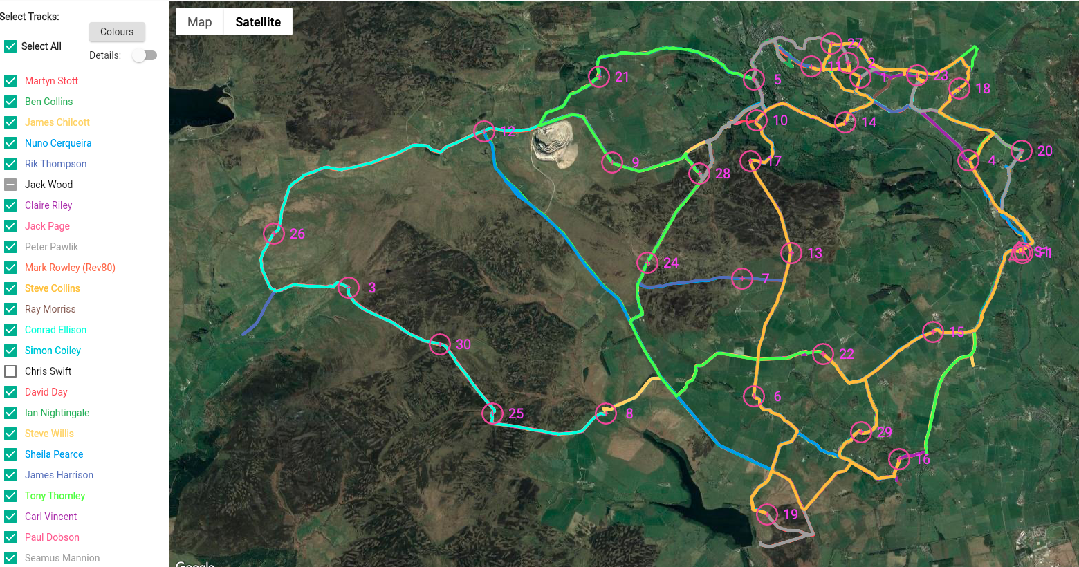
Here’s the course map for next Saturday July 22nd at Grewelthorpe.
Online entry closes midnight Thursday 20th (50% off for entries by midnight Wednesday 19th)
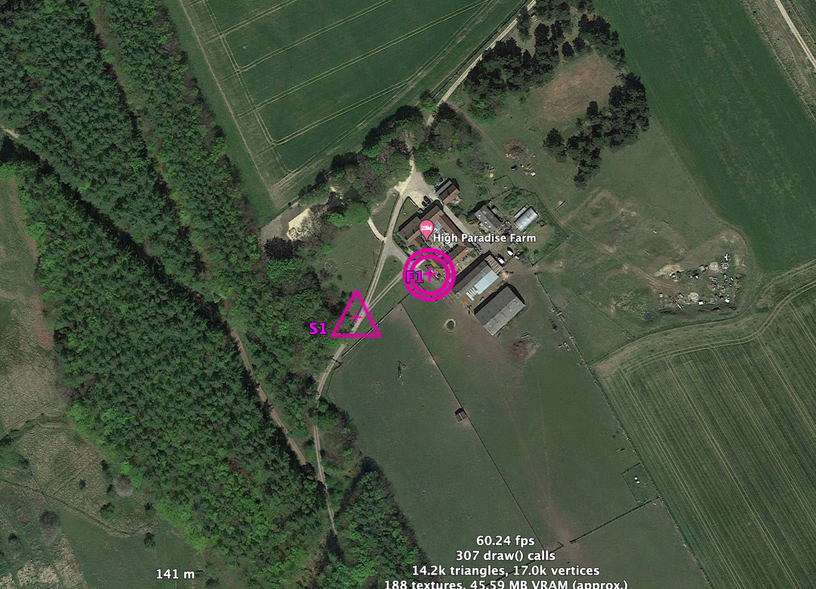
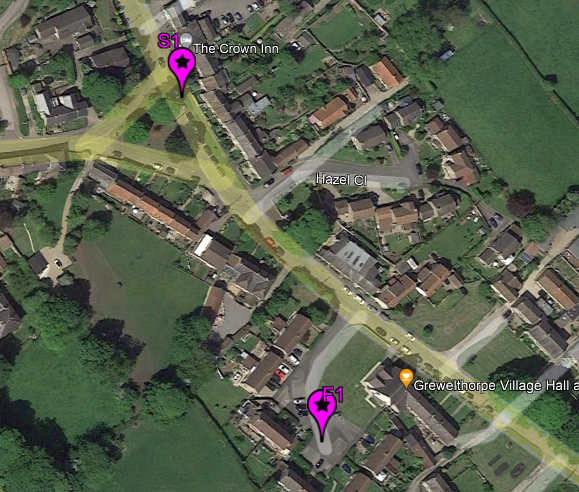
The event centre is the Village Hall (postcode HG4 3BU, GR 231 761)
Registration 0900 – 1015 | Starts 0930 – 1030 | 3 hour course time
The Grewelthorpe area has been used before for bike O but David Day has found some bridleways for you to explore which should be new to most of you.
The area will include some fantastic views of North Yorkshire from the moors to the east; a complex variety of minor roads with little traffic; some navigational decisions on the many BWs. The Swetton Moor BW is mapped as invisible & is not recommended; the Holmes Farm BW is also mapped as invisible but is a good grass surface & perfectly rideable. There is a ford on the BW S of Hedge Nook which will normally be calf deep & not recommended. The BW through Galphay Woods has been diverted & the map has been corrected to reflect the new route.
Grewelthorpe Cafe will be open before & after the event but they are asking for pre-orders
by midnight Wednesday prior. Menu is attached, soup choices are mushroom or carrot &
coriander; there are also bacon rolls at £3.50. Food choices to David by the entry deadline:
ripondays@gmail.com
There is no car park for this event; please park tidily in the village but not on the green.
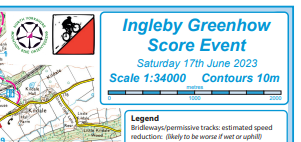
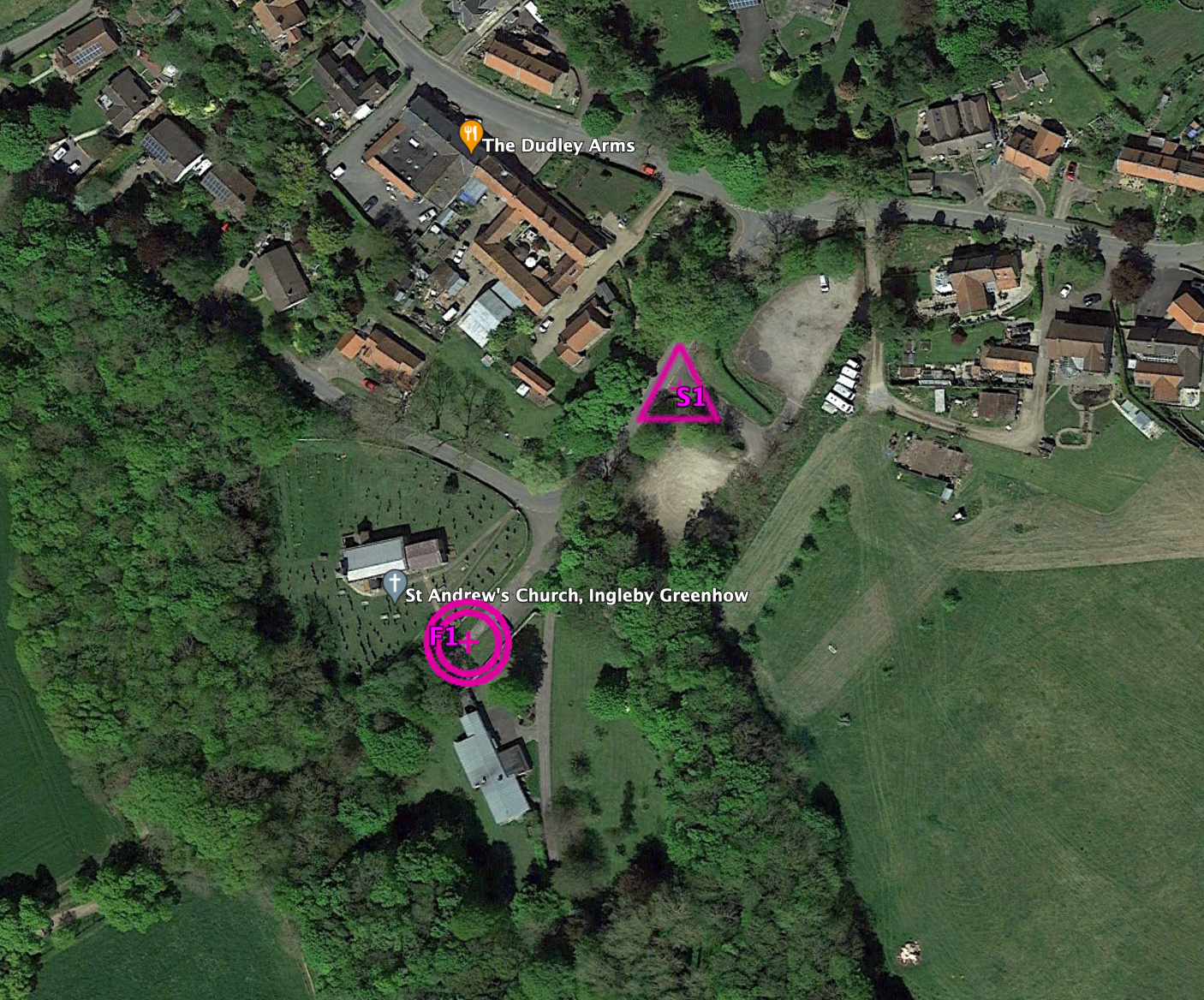
COURSE MAP AND START & FINISH LOCATIONS:
![]()